Hail Raiser

Atmospheric Science Students, STS Students

By Madisen Lindholm

As a weather lover, I always fangirl when a big storm rolls through. I love going outside or chasing it (safely) and seeing all aspects of the storm. Sometimes before a thunderstorm that will produce hail, mammatus clouds form. Mammatus clouds are bubbly in appearance, and are considered unique, but we often see them in the Black Hills. These are my favorite clouds due to how unique they are and how telling of the storm components they are.
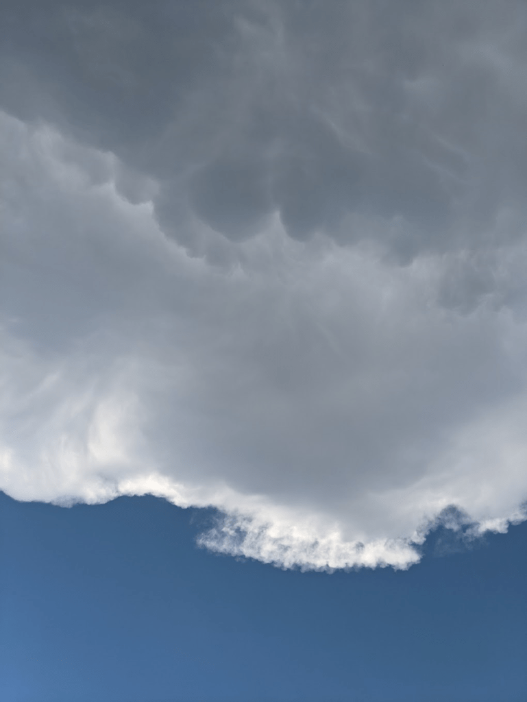
Clouds against a blue sky. The sky is visible at the bottom of the image and above that dark, bubbly mammatus clouds take up most of the image.
This image was taken last summer from Rushmore Crossing. Up at the top of the image are the dark, bubbly mammatus clouds. Mammatus clouds typically foreshadow hail, and are rare in most areas, but are somewhat common during the summer in South Dakota.

I especially love the aftereffects of a thunderstorm. The stillness in the air, the rainbows, the smell of freshly fallen rain, and the glow of the atmosphere are all amazing to me. It also amazes me how much energy storms produce and use as they race across the plains of South Dakota, dropping rain, wind, hail, and lightning as they go. One storm that particularly amazes me is one that occurred on July 23rd, 2010, in Vivian, SD. This storm produced the largest hailstone ever recorded in the United States (3D printed model pictured above). This hailstone is 8 inches in diameter, 18.6 inches in circumference and weighs nearly 2 pounds! Imagine that hitting your house!

Because I have always loved severe weather, I knew my senior research topic needed to be in that category. I especially find hail fascinating, so I decided to use hail as my main topic. South Dakota summer thunderstorms are known for the hail they bring. From car damage, broken windows, roof damage, livestock casualties, plant damage, and human casualties, hail causes many problems. As a lifelong South Dakotan, there have been many times I have been out and about when suddenly I get a National Weather Service emergency warning about hail, but by that point it is too late to move my car into a safe area. Over the years, it has seemed like hail has increased in frequency and size on a regular basis. For example, last summer it seemed like the majority of storms brought at least pea-sized hail, where just a decade ago I remember hail being a more special occurrence. This struck me as an important hypothesis to address because as climate change becomes worse hail will, too, so I figured it would make for an interesting capstone project.
To Dust We Shall Return?

Atmospheric Science Students, STS Students

By Lillian Knudtson

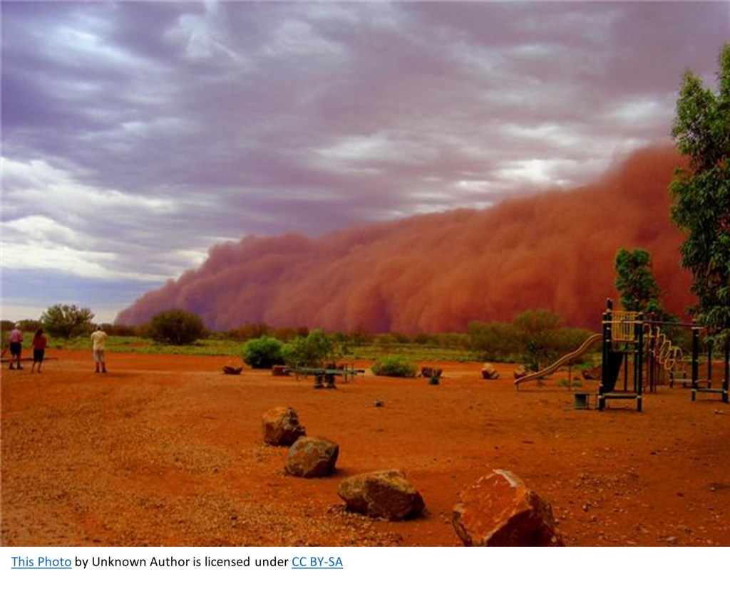
Weather affects all people, and it is important for meteorologists to understand a wide range of events to communicate effectively to the public. My capstone is a project designed to dissect a particularly interesting phenomenon, especially to South Dakota. I have chosen to do a case study of a particular dust storm known as a haboob. The storm I am focusing on occurred May 12th, 2022, and it impacted the eastern part of South Dakota. A widespread, long-lived thunderstorm called a derecho created the haboob beginning in the south central portion of Nebraska and traveled north and east towards Sioux Falls. It sustained winds of 80 miles per hour, and the highest recorded winds of the event were 107 miles per hour. This storm is a good example of what is possible and can become a sample case for the future.

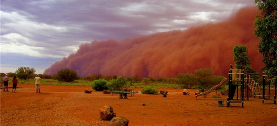
Photo of giant reddish-brown dust cloud blowing in from the right side of the image, approaching a playground and a few people watching it.

A haboob is a giant dust storm. It is named after the Arabic word habb, meaning “blown.” This type of storm is most common in the Middle East and Northern Africa, where is it historically arid. But haboobs are also well known in the Southwestern United States and are becoming an occurrence in previously unlikely places as well. Haboobs are created from loose particles that are picked up by strong winds caused by storms like monsoons or derechos sweeping across the surface of the earth. The massive amount of precipitation associated with these events evaporate, which is a cooling process, so cool air called a gust front accelerates out in front of the storm at a fast rate, picking up particles and building a wall of air and dirt. The particles are mostly less than 10 micrometer pieces of dirt, dust, and sand, but they can be as large as a pea, and the wind can pick up other debris along with it. These walls of air and dirt can reach grow to 5000 feet tall and 100 miles wide, and they can move at 60 miles an hour (Eagar, Herckes, Hartnett, 2016). Overall it is a phenomenon that is quite terrifying.

It Spins Me Right Round: What’s The Big Deal With Tornadoes?

Atmospheric Science Students, Environment, STS Students

By Cory Schultz

If you look at the annual average number of tornadoes per country, the United States reigns supreme, whether we like it or not. And if we look at South Dakota, the state is not without its share of tornadic activity. For instance, as Dennis Todey, Jay Trobec, and H. Michael Mogil write, “A massive outbreak of tornadoes placed the state in the severe weather record book on the evening of June 24, 2003” (19). On that day, sixty-seven tornadoes touched down over a 6-hour period, a single-state record tornado occurrence.

So, you may be thinking to yourself right now, “I live in the Black Hills region of South Dakota. We don’t have a problem with tornadoes.” Well, what if I told you that tornado activity has increased in the Northern Black Hills of South Dakota in the last decade? This increase in activity is not typical for the Northern Black Hills, since only nine tornadoes have been reported in this region since NOAA started gathering tornado data in 1950. What makes this even more alarming is that, of these nine cases, four have occurred in the last decade. This increase is the focus of my capstone with my two-part research question: Do the Northern Black Hills tornadoes that occurred in 2015, 2018, and 2020 have any similar characteristics to each other? Will this help determine when new tornadoes will form over the same region? 

Map of the Black Hills showing tornado tracks and the strength of the tornadoes. A handful are circled west of Lead, SD.
Map of Northern Black Hills tornado tracks and strengths on the EF scale. Red circles indicate tornadoes being researched for this capstone. Source: National Oceanic and Atmospheric Administration

How Fires Can Create Clouds

Atmospheric Science Students

By Jackson Zito

Jackson is majoring in Atmospheric and Environmental Sciences at South Dakota Mines. He plans on working with wildfires and the development of pyro-cumulus and pyro-cumulonimbus clouds.

When people ask me why I am going to school, I often tell them it’s to get a degree so I can hopefully get a job. After that answer we usually have a conversation like this:

Them: Cool, so what are you learning then? 
Me: Atmospheric and Environmental Sciences. 
They look at me in confusion as if I just spoke a foreign language. 
Me: It’s meteorology. 
Them: Oh, so you’re going to be a weather boy like the one on TV then. 
Me: No, you know there is a lot more you can do with a meteorology degree than just be on the nightly news.
Them: Like what? 
Me: Well, right now I am researching pyro-cumulonimbus clouds. 

Assuming you have a confused look on your face as they often do, let me explain.

Searching for a Place to Live with the Most Ice and Thunderstorms

Atmospheric Science Students, STS Students

By Steven Slater

Steven is majoring in Atmospheric and Environmental Sciences, and his primary interest is extreme weather.

Ever since I can remember, I enjoyed watching the rare thunderstorms whenever they occurred in Western Washington. I often had to wait a year or more between seeing individual lightning bolts. I often watched The Weather Channel as my main source of weather-related content, whether it had to do with storms or snow. My mind was blown as I watched the reported snow totals rise close to 12 feet for the lake-effect vent in February 2007.

The lowlands of Western Washington don’t receive much snow, so I had to wait for that, too, though it happened more frequently than thunderstorms. I was an advocate for receiving as much snow as possible in the shortest time. The biggest event I experienced in Washington was in December 2008, where I remember playing in ~15 inches of snow at the peak of the event.

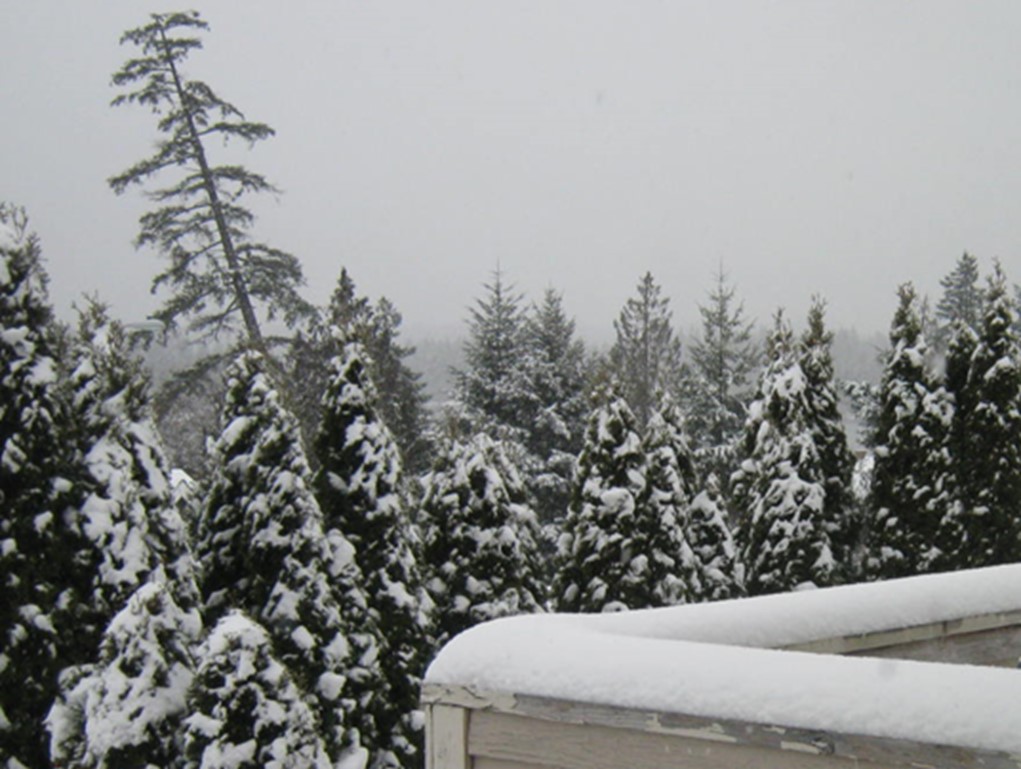
A picture containing tree, outdoor, sky, snow.
Washington in January 2012. Photo: Steven Slater.