
By Jackson Zito
Jackson is majoring in Atmospheric and Environmental Sciences at South Dakota Mines. He plans on working with wildfires and the development of pyro-cumulus and pyro-cumulonimbus clouds.
When people ask me why I am going to school, I often tell them it’s to get a degree so I can hopefully get a job. After that answer we usually have a conversation like this:
Them: Cool, so what are you learning then?
Me: Atmospheric and Environmental Sciences.
They look at me in confusion as if I just spoke a foreign language.
Me: It’s meteorology.
Them: Oh, so you’re going to be a weather boy like the one on TV then.
Me: No, you know there is a lot more you can do with a meteorology degree than just be on the nightly news.
Them: Like what?
Me: Well, right now I am researching pyro-cumulonimbus clouds.
Assuming you have a confused look on your face as they often do, let me explain.
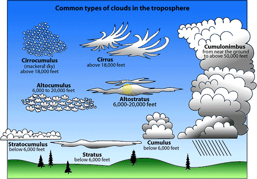
Pyro-cumulonimbus clouds are storm clouds that often form from fires. They develop when certain atmospheric conditions play out over a wildfire and you can see a cloud develop over the fire. Sometimes the cloud will just be a normal cloud like the ones you see on an everyday basis, which is called a pyro-cumulus cloud. Other times these clouds will become storm clouds, which can produce rain, lighting, hail, wind, and sometimes tornadoes. These clouds are called pyro-cumulonimbus clouds. Pyro is the Latin for fire, and cumulus and cumulonimbus are the respective types of cloud. Cumulus clouds are the white puffy clouds you see close to the surface. Cumulonimbus clouds are storm clouds that form close to the surface and rise up to the edge of the Troposphere (the first layer of the atmosphere). These are the clouds that you see with thunderstorms and severe weather.
When a cloud forms in the atmosphere, what you are seeing is water condensing because of the decrease in temperature as air rises. This happens because as you go up in the first layer of the atmosphere the temperature decreases, and when the temperature hits a certain point water in the atmosphere condenses and you get a cloud. You also see this at the surface with fog. Fog is essentially a cloud that develops at the surface.
In meteorology when we look at temperature, we look at two different types. They are air temperature and dew point temperature. The air temperature measures the temperature in the air. The dew point temperature measures the temperature at which the air temperature would need to reach to get water to condense. When the dew point temperature is reached, this is where you start to see fog, as well as dew on the grass. When looking at how a pyro-cumulus and pyro-cumulonimbus clouds form, while the process does share some similarities to the formation of regular clouds, there are more factors that need to play out.
In order to even get a pyro-cumulus or pyro-cumulonimbus cloud, you first need a strong fire. When you have a strong fire, these fires create their own environment. The heat from the fire generates lift. As the air is lifted, this air will cool as it goes up.
However, because fires tend to be hot and dry, you also need certain environmental factors in the atmosphere to generate a pyro cloud. One of the biggest factors that helps in the formation of pyro clouds is a condensation nucleus of some sort. A condensation nucleus is a particle in the atmosphere that helps water to condense. These condensation nuclei can come from smoke/dust stirred up from the fire, or they come from ice particles in the atmosphere. The reason these condensation nuclei are important is because they help in getting the small amounts of water vapor in the atmosphere around the fire to condense. Other things that help in getting a pyro cloud to form are hot surface temperature (which comes from the fire) to create that lift and low relative humidity to keep the fire burning. For those who may not be familiar with relative humidity, it’s the measurement of water vapor in the air as a percentage. Another factor in generating a pyro cloud is a deep mixing layer, which is when the atmosphere allows air to rise. These atmospheric factors that contribute to the formation of pyro clouds is where I plan to focus my capstone to get a better idea of what causes them to develop.

While we have a good amount of research on pyro clouds, they are still very rare. It’s hard to get all of the environmental factors to play out. By gathering more research on what environmental conditions cause pyro clouds to develop, we can use this data to possibly predict these clouds to give us an idea on how the cloud might affect the fire. Using this information, we can hopefully get a better idea on how to predict these clouds which can help in saving lives, fighting fires, and saving the taxpayer’s dollar (because fighting fires is really expensive). I plan on using meteorological models – including Python, skew-t diagrams, radar data, and satellite images – to observe pyro clouds at the microstructure. By looking at the microstructure of these clouds, I can use the data to see what environmental factors lead to the development of the pyro cloud.
So, I hope that helps in answering the question of how fires make clouds. I hope that the next time someone says to you that they are getting a degree in meteorology, you don’t immediately think of the meteorologists that are on the nightly news because there is far more you can do with a meteorology degree then being on camera.
This is the third in a series. Please also check out previous posts: “Balancing Expectations: Preserving the Nature and History in South Dakota” by Louise Swanson and “Searching for a Place to Live with the Most Ice and Thunderstorms” by Steven Slater.

One thought on “How Fires Can Create Clouds”