What’s Up with the Polar Vortex?

Atmospheric Science Students

By Emily Novak

You may have heard of the polar vortex before on TV or in a news article, most likely when there is an extreme polar air outbreak. Some notable polar vortex events in the past years have been in 2014, 2019, and 2021. Maybe you remember school being cancelled or going outside to feel a biting cold the second you stepped out the door. I was one of the curious kids who wanted to go outside and found my eyelashes trying to freeze shut. I’ve always loved winter weather, but I know how detrimental it can be for people who aren’t prepared. This interest in extreme cold and its dangers, along with guidance from my supervisor, is what led me to the polar vortex.
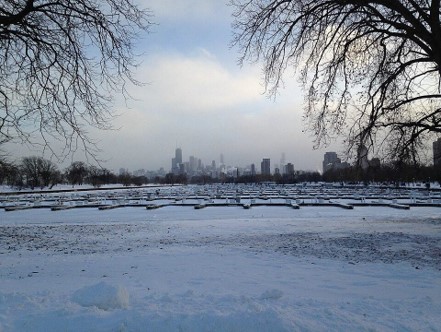
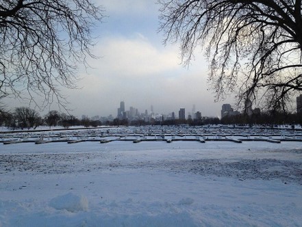
Image of downtown Chicago covered in snow.
View of Downtown Chicago from Diversey Harbor during 2014 Polar Vortex. Photo credit: edward stojakovic (Creative Commons 2.0).

The question I will be exploring for my capstone project is this: Is the Arctic stratospheric polar vortex weakening? The polar vortex is a circulation of strong winds that contains cold air and happens every winter in the poles (Lindsey, 2021). The Arctic/North Pole vortex is stronger and varies more than that in the Antarctic/South Pole, so I chose to focus on the Arctic polar vortex for my research. There is both a tropospheric and stratospheric polar vortex. What’s the difference? Stratosphere refers to the second layer of the atmosphere, and the stratospheric polar vortex happens 10-30 miles above Earth’s surface! “Arctic stratospheric polar vortex” is a bit of a mouthful, so it is more simply referred to as “the polar vortex” if you live in the northern hemisphere. There is also a tropospheric (the troposphere is the layer of the atmosphere we live in and where we experience most of our weather) polar vortex often called the polar jet stream. Unlike the stratospheric one, this vortex exists year-round, not just in the winter months, and occurs 5-9 miles above the surface. The tropospheric polar vortex has short-term effects on our day-to-day weather, while the stratospheric polar vortex influences the Arctic’s entire season (Lindsey, 2021).
River Flooding in the Black Hills

Atmospheric Science Students

By Misael Trejos Ingerson

Flooding is a major source of property damage in the United States, whether from coastal tides, heavy precipitation, or snowmelt. All can affect the public and potentially cause major loss of life, like in the 1972 Rapid Creek Flood. However, forecasters around the country work around the clock to inform the public about natural hazards using technology and techniques created and improved over decades. These technologies interest me, specifically hydrologic models that help provide guidance to forecasters on river water levels. This guidance increases forecast accuracy and reliability while also increasing lead time for decision-makers to make important operations.

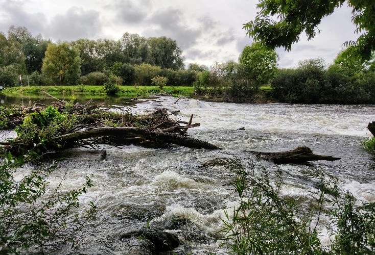
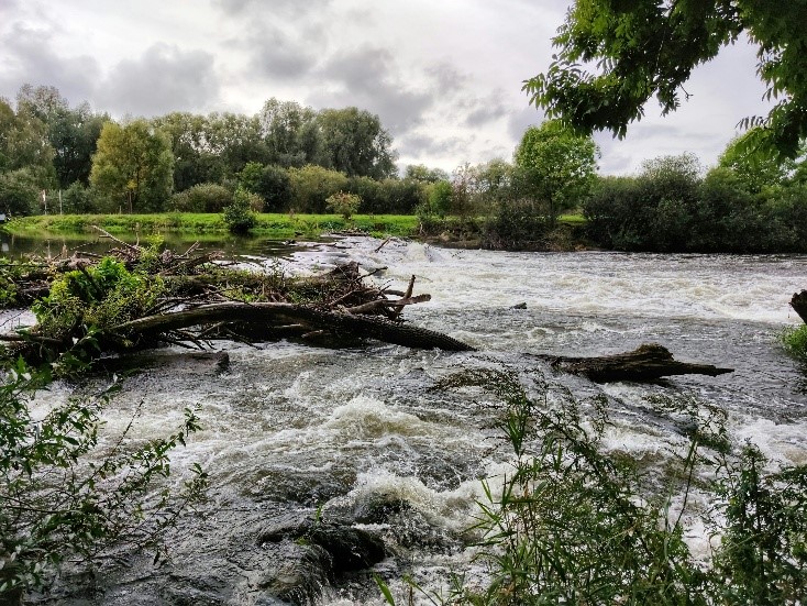
Fast-moving river with tree log in the water.
Brown tree log on river by Nazrin Babashova on Unsplash.

For my capstone project, I decided to look at a hydrological model called the National Water Model. This model aims to help guide forecasters and decision-makers in the event of a flash flood for streams and rivers that do not have coverage from stream gauges. These gauges are situated across the country and observe the current water level, giving forecasters vital data for their forecasts. Despite the over 12,000 gauges in the United States, only 3% of stream miles are accurately represented, according to Esri. This is a service gap that the National Water Model intends to cover, which is why it is important that the data being output is accurate and reliable.

Snow or No Snow?

Atmospheric Science Students

By Hailee Davis

Have you ever wondered if mountains have an impact on weather? I began to wonder about this when I moved to the Black Hills and discovered that there is a whole section of research dedicated to this called Alpine Meteorology.

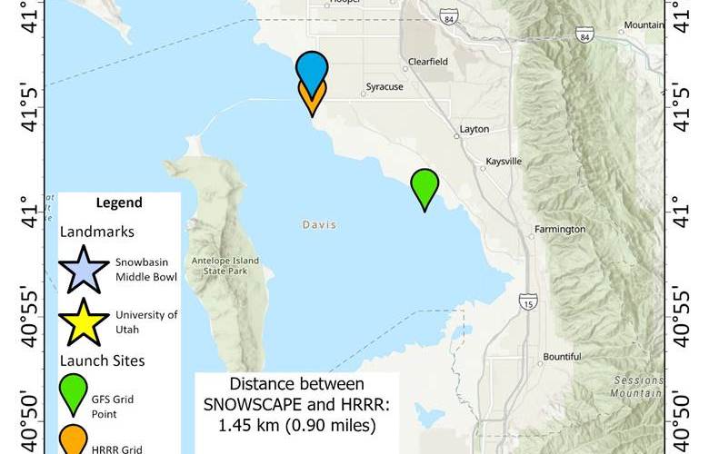
Given my interest in this topic, I applied for and received an internship with The University of Utah’s Research Experience in Alpine Meteorology. Through this, I got to work with data from the Seeded and Natural Orographic Winter Storms and Catchment Processes Evaluation (SNOWSCAPE) field campaign that took place from January – March 2026 in the Northern Wasatch Range in Utah. The goal of the campaign was to improve the understanding of winter storm processes and evaluate the efficiency of cloud seeding using ground generators. You can read more about the campaign through the Utah Division of Water Resources website. As a part of this campaign, weather balloons were launched, collecting data on the temperature, dewpoint, wind speed, and wind direction as they go up in the atmosphere.

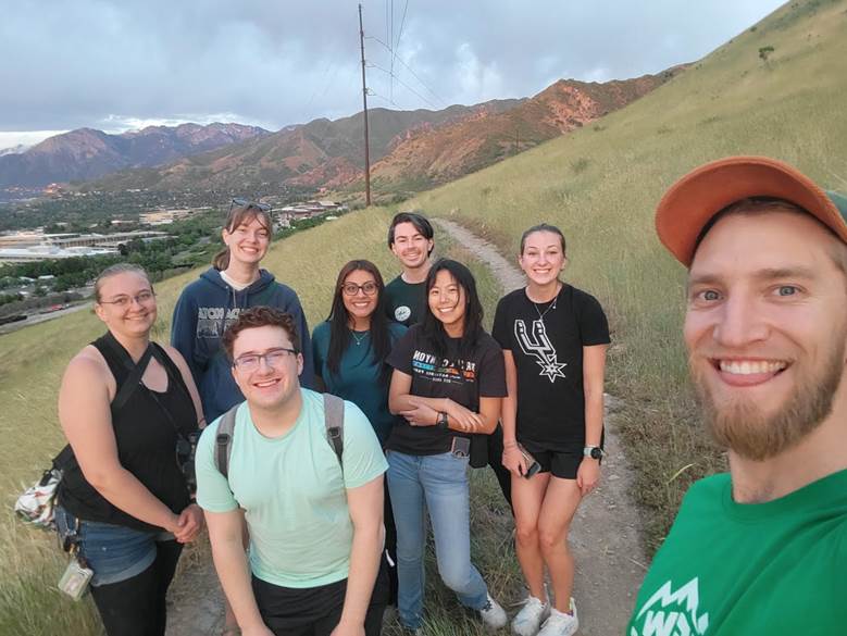
A photo of people standing outside.
Photo of the intern group at The University of Utah. Property of Hailee Davis. Credit: Enzo Peters.

Not All Tornadoes Are Created Equal: Understanding Colorado’s Tornadoes

Atmospheric Science Students

By Alexa Roth

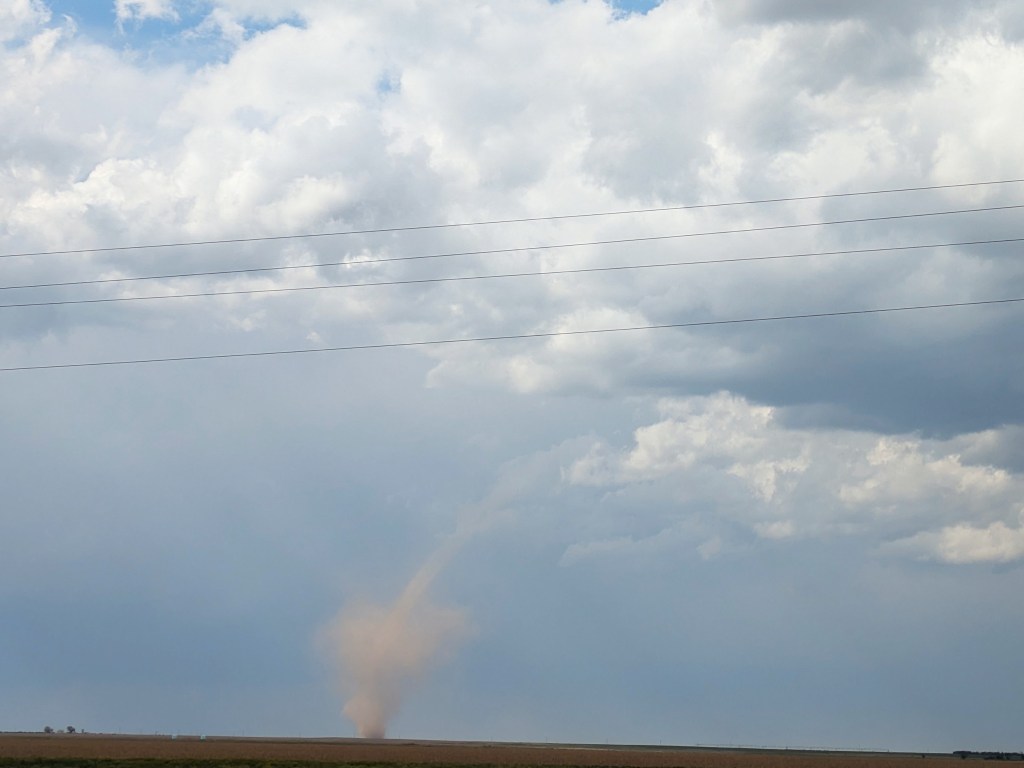
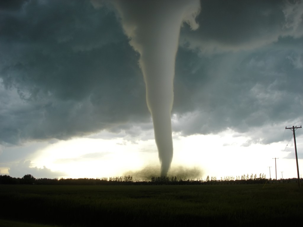
Colorado experiences dozens of tornadoes every year, but despite this number there have been very few tornadoes rated EF-3 or higher In fact, many of these tornadoes are quite different than what many people might think of when they hear “tornado.” People may associate tornadoes with just the tornadoes that are connected with supercells; however, there are also tornadoes that are connected to non-supercell storms.

Photo of a landspout tornado touching down, with lots of dust flying up near the ground.
Stefan Klein, Landspout Tornado near Kirk, CO, via Wikimedia Commons, Creative Commons Creative Commons Attribution 4.0 International.

Exploring Ensemble Spread over the Black Hills

Atmospheric Science Students

By Adam Schaubroeck

During my first semester here at South Dakota Mines, I thoroughly enjoyed my atmospheric science introductory class. In this class my professor would often discuss current weather events and use a wide variety of information to back up what he was saying. One such source of information was atmospheric models. These atmospheric models caught my attention and have fascinated me ever since. This has led me to a bigger interest in our atmosphere from a computational perspective.

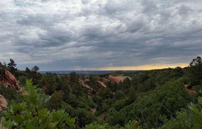
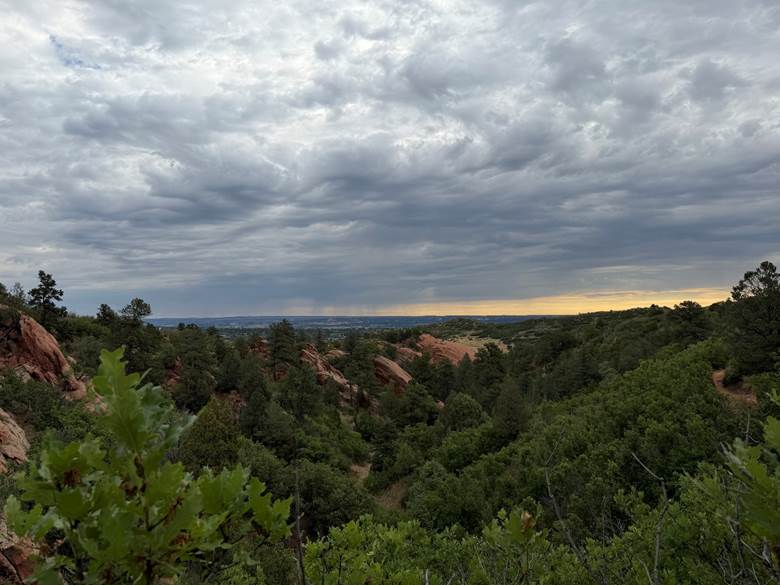
Photo of clouds over Red Rocks in Colorado.
Red Rocks Canyon overlooking Colorado Springs on July 27th, 2026. Photo by Adam Schaubroeck.

Do You Really Understand Weather Warnings? The Effects of Individuals’ Background on Understanding Severe Weather Messaging

Atmospheric Science Students

By Alex Makarchuk

Imagine you are having dinner with your family, and suddenly a warning from the National Weather Service (NWS) blares on your phone: “TORNADO WARNING ISSUED FOR YOUR AREA.” Your first response to the loud noise and a scary message may put you and your family in a panic or leave you in a state of confusion, as the words used in the warning make you unsure how to keep your family safe. Public communication is one of many jobs of a meteorologist, and one of the hardest.

Photo of a funnel cloud touching down.
Justin1569 at English Wikipedia, CC BY-SA 3.0, via Wikimedia Commons.

NWS sends out just over 50,000 warnings a year across the country (Erdman 2022) to protect the public from damage that Mother Nature can cause. These warnings and messages only work if the reader can understand the message. If someone doesn’t understand what is happening right now, how are they supposed to take shelter and make informed decisions on what to do next? Sharing these warnings with millions of people across the country is a difficult job, which is why it is so important that we can build these messages so that everyone can understand the dangers and take proper action. It starts with understanding how people interpret these messages and why they interpret them that way.

Where Does Our Food Go When We Throw it Away? How City-Led Food Waste Composting Diverts Waste and Benefits Communities

Atmospheric Science Students

By Emily Hubmer

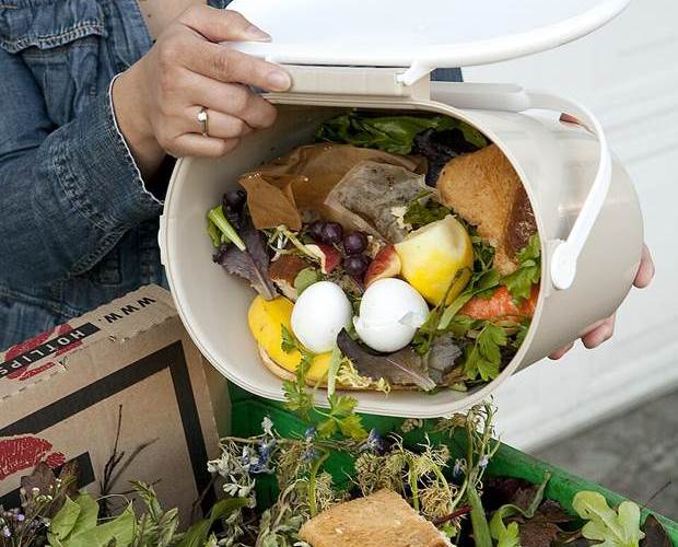
Before coming to school at South Dakota Mines, I was interested in environmental science from a different lens than I am now. I used to love learning about and watching documentaries focused on sustainability, mostly related to agriculture and other practices in the production of goods. As a college student, my courses have focused on other topics related to environmental science. I’ve studied chemical and biological processes, community science and communication, water and wastewater treatment, among other fields. The courses I’ve taken and the fields I’ve studied have inspired my capstone project. Like most, I want to help as many people as I can and leave a positive impact on my surroundings. One way that I can help our planet, and what I will be doing my capstone project on, is composting.

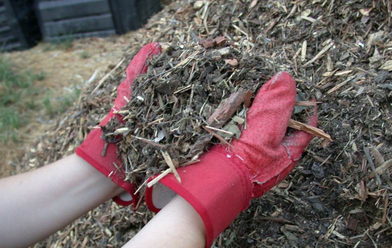
A photo of hands in gloves handling compost.
Dvortygirl, CC BY-SA 3.0 https://creativecommons.org/licenses/by-sa/3.0, via Wikimedia Commons.

Composting is the process of breaking down materials into compost, which is a nutritionally dense substance. Typically, in landfills, when food breaks down, it is in a low-oxygen environment. The resulting byproduct of that decomposition is methane. When composted properly, the waste is exposed to oxygen, resulting in the emission of carbon dioxide. I know, an environmental science student promoting the release of carbon dioxide? While carbon dioxide is a harmful greenhouse gas, methane is also a greenhouse gas, and it is much stronger than carbon dioxide and can have a greater impact with the same amount of gas produced (Howarth, 2014). The breakdown of material into compost can benefit communities. The product can be used to help crops grow better in gardens, among other uses. Essentially, composting food waste reduces the amount of trash going into landfills, prevents methane emissions, and makes a useful end product.

No Two Snowflakes Are Alike! Analyzing Precipitation Development of Two Different Blizzards

Atmospheric Science Students

By Kendra Rounds

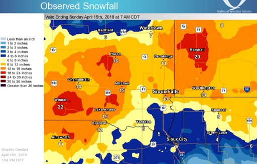
Snowstorms and blizzards can have immense impacts on human infrastructure, create hazardous travel conditions, and shut down cities due to snow and ice accumulation. Many people know this in general about snowstorms but have never considered if there’s any difference between snowstorms at different times of the year.

During midwinter – in, say, January – temperatures are colder overall with less sunlight during the daytime to diminish snow accumulation. Snowflakes that form around this time may be smaller and more powder-like. This can reduce visibility more quickly during snow events such as blizzards, which makes traveling conditions more hazardous. During early spring – in, say, April – temperatures are generally warmer with more sunlight throughout the day. While this typically means the effects of a snowstorm won’t last quite as long, the snow that falls is usually thicker and heavier, often called “wet snow.” This snow is much harder to clear from roadways and can cause power outages more easily due to the weight of the snow on powerlines. Many people probably wouldn’t consider that these storms can be so different if they don’t look at the underlying meteorological properties of these storms.

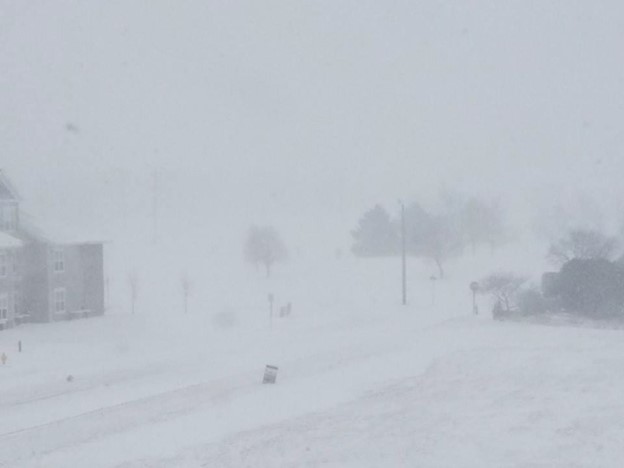
Photo showing low visibility during a blizzard. Some buildings and trees are barely visible through blowing snow.
Low visibility during a blizzard in Yankton, SD, on April 14th, 2018. Photo taken by Heidi Harms Henson courtesy of the Sioux Falls, SD National Weather Service Weather Forecasting Office.

Balancing Ecosystems and Scientific Understanding Along the Kootenai River

Atmospheric Science Students

By Hannah Gehlsen

Over the course of my college career, I have come to realize, like many others, that there is a gap that exists between not only scientists and the public, but within varying scientific disciplines as well. As a result, many ecologically valuable elements are continually in need of research to support their existence. This issue is currently being faced in regard to the riparian vegetation/macrophytes of the Kootenai River, with some finding them problematic to stream flow and others simply seeing them as a nuisance while fishing. To clarify, riparian vegetation is known to grow along the edges of water bodies, whereas macrophytes are aquatic plants that are typically rooted underwater, and they can be fully or only partially submerged.

Historically speaking, the Kootenai River is considered to be low in nutrients such as phosphorous. This is primarily a result of the installation of the Libby Dam in 1972, which originates in Southeastern British Columbia, Canada, and flows through northwestern Montana and northern Idaho (Hardy et al., 2022). These low nutrient levels are what put aquatic species, such as the white sturgeon, under threat due to a shift in the ecosystem balance. Nutrients such as phosphorous, nitrogen, and even carbon are critical to maintaining the balance within both aquatic and terrestrial ecosystems. They also work to uphold a proper functioning food-web.

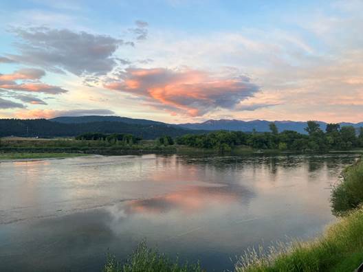
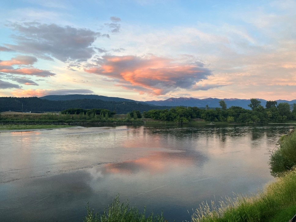
Image of water with greenery surrounding and mountains in the background.
Image credit: Hannah Gehlsen

Montana Wildfires: What Drives Local Fire Danger?

Atmospheric Science Students

By Jack Knighton

Globally, wildfires are becoming more common. Research indicates that peak wildfire season has lengthened for over 25% of the Earth’s vegetated surface, causing an 18% increase in global mean fire season length (Jolly, et. al, 2013). In an October 2024 report, the Montana Legislative Fiscal Division found that 70% of the acres burned in Montana history have occurred after the year 2000. The report also found that Montana spent over $500 million dollars suppressing fires between 2002 and 2023, with a further $1.8 billion having been spent by federal agencies. With wildfires becoming more common, it is increasingly important that we understand local wildfire behavior to aid with suppression efforts.

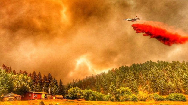
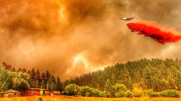
A photo of an aircraft flying over trees with smoke in the background and dropping fire retardant.
Aircraft drops fire retardant on the 2021 Richard Spring Fire in Montana, photo by Phil Millette, FWS.

Wildfire behavior is driven primarily by weather, topography, and the availability of fuel. Fuel availability varies throughout the year, and is primarily a function of moisture, vegetation type, and vegetation density.  Vegetation type and density are driven by the amount of annual precipitation and average temperature. Drought impacts fuel moisture, allowing for more easily combustible fuel and increased rate of fire spread. Previous research (Clabo, 2018, Westerling et. al, 2003) has indicated that there may be correlations between local climate variables and increased wildfire activity, however no dedicated study has been conducted for Montana.